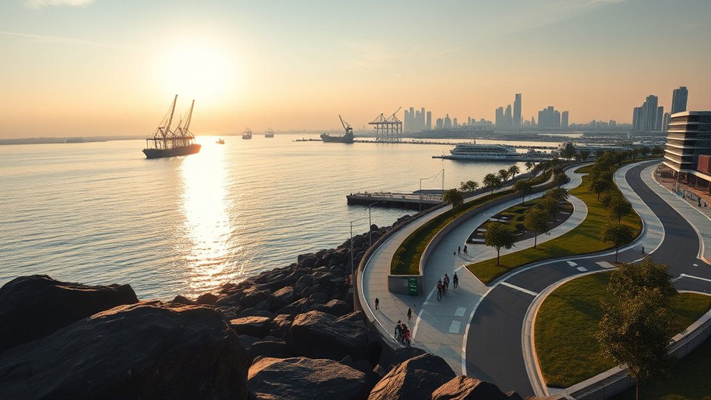
The Greater Southern Waterfront (GSW) represents one of the most comprehensive urban transformation initiatives undertaken in modern Singapore. Extending along 30 kilometers of the southern coastline from Pasir Panjang to Marina East, the district encompasses approximately 2,000 hectares of prime land. As commercial port activities progressively relocate to consolidated facilities, this coastal corridor will transition into a vibrant gateway for living, working, and leisure. At the western anchor of this master-planned corridor lies Pasir Panjang, a historic maritime district poised for long-term residential and economic evolution.
The Long-Term Scope of the Greater Southern Waterfront
Formalized within statutory planning blueprints published by the Urban Redevelopment Authority (URA), the Greater Southern Waterfront spans an area six times the size of Marina Bay. Rather than executing a singular rapid redevelopment, the Singapore Government has structured the project across multiple decades to ensure balanced land allocation, sustainable infrastructure development, and seamless integration with surrounding nature corridors.
The urban vision emphasizes mixed-use precincts that blend residential neighborhoods with commercial enterprise, civic spaces, and coastal recreation. Early phases focus on brownfield site preparation, soil remediation, and utility infrastructure installation. Over time, commercial and residential developments will progressively link the southern ridge parks with the waterfront, creating continuous public access along the coast from West Coast Park through Labrador Nature Reserve to the Central Business District.
Tuas Port Consolidation and Coastal Land Reclamation Timelines
The catalyst unlocking the Greater Southern Waterfront is the progressive consolidation of container shipping operations at the mega Tuas Port. Under a coordinated maritime strategy, terminal operations at Tanjong Pagar, Keppel, and Pulau Brani are systematically shifting westward, freeing up hundreds of hectares of city-fringe land. The operational container terminals at Pasir Panjang are scheduled to follow in later phases, with port activities slated to fully consolidate at Tuas by 2040.
This phased decanting of heavy port logistics provides planners with an orderly sequence for civil engineering and infrastructure delivery. For instance, transitional industrial properties in adjacent areas are already preparing for turnover, such as documented in our coverage of the Greater Southern Waterfront timeline and Keppel Road facilities vacating by 2028. As berths and container yards are decommissioned, coastal modification and parcel preparation will create prime development land fronting the Singapore Strait.
Adaptive Reuse of the Historic Pasir Panjang Power District
A central feature of the transformation in District 5 is the preservation and adaptive reuse of the Pasir Panjang Power District. Commissioned during the 1950s and 1960s to fuel Singapore’s early industrialization, Power Station ‘A’ and Power Station ‘B’ feature monumental industrial architecture characterized by red-brick facades, cavernous turbine halls, and towering internal volumes.
Rather than demolishing these heritage assets, public master-planning initiatives organized by the Urban Redevelopment Authority have designated the 15-hectare power station compound for heritage preservation and adaptive reuse. Architectural proposals envision transforming the decommissioned power halls into cultural performance venues, design incubators, creative retail hubs, and public event plazas. Situated directly on the water, the precinct will connect to Labrador Nature Reserve and the Rail Corridor, establishing an active recreational node that celebrates Singapore’s industrial heritage.
Public Transport Expansion and Circle Line 6 Connectivity
Infrastructure delivery serves as the backbone of the southern coastal transformation. Chief among these transport improvements is the completion of Circle Line Stage 6 (CCL6), managed by the Land Transport Authority. As detailed in official LTA Circle Line 6 project updates, the construction of Keppel, Cantonment, and Prince Edward Road stations closes the loop between HarbourFront and Marina Bay.
Closing the Circle Line loop dramatically enhances rail connectivity for commuters travelling from Pasir Panjang, Haw Par Villa, and Labrador Park. Residents along the Pasir Panjang corridor gain direct, interchange-free access to Marina Bay, Shenton Way, and the Downtown Core without having to transfer at busy transit hubs. Furthermore, the corridor benefits from immediate proximity to existing employment nodes, including Mapletree Business City, Alexandra Technopark, the National University of Singapore (NUS), and the one-north research cluster.
Residential Supply and Private Housing Dynamics in Pasir Panjang
Pasir Panjang’s existing private residential landscape is characterized primarily by low- to mid-density freehold and 99-year leasehold condominiums, low-rise walk-ups, and quiet landed enclaves tucked into the lush topography of Kent Ridge. This lower plot-ratio environment has historically appealed to homeowners seeking city-fringe convenience alongside natural green surroundings.
Recent redevelopment projects have set fresh valuation benchmarks for the neighborhood. Developments such as the freehold Terra Hill on Yew Siang Road demonstrate strong underlying demand from both owner-occupiers and long-term investors seeking modern low-rise luxury near the coast. Readers can review project positioning in our report on Terra Hill in Pasir Panjang.
Looking ahead, future public and private housing pipelines will substantially expand the residential community. Neighboring parcels, such as the redevelopment of the former Keppel Club golf course into the Berlayar residential precinct, will introduce thousands of new homes, including waterfront public flats under Prime and Plus models alongside private strata developments. For insight into how nearby estates will integrate with coastal redevelopment, see our analysis of the new Berlayar estate transformation.
Realistic Horizons and Investment Due Diligence for Property Buyers
While the long-term fundamentals of the Greater Southern Waterfront are supported by committed state planning, prospective property buyers must approach the district with measured expectations. Urban renewal on this scale involves multi-year gestation periods. Major infrastructure milestones, port decommissioning exercises, and new commercial hubs will materialize progressively across successive Master Plan cycles rather than delivering immediate overnight capital surges.
Buyers should base their purchase decisions on tangible current attributes: proximity to MRT stations, access to established employment clusters, natural landscape views, and sustainable rental yields supported by tenant pools from NUS, NUH, and one-north. Choosing properties with sound floor plan layouts, practical maintenance fees, and sensible entry prices ensures that homeowners and investors remain comfortably positioned while the long-term southern coastline vision gradually unfolds.

One thought on “Greater Southern Waterfront: Pasir Panjang Property Outlook”